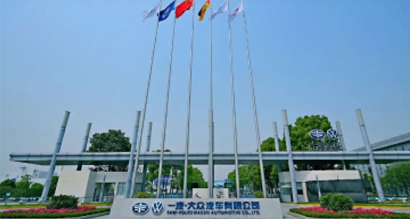
Give a chestnut! Tableau Tips (93): Mark a map or scatter plot with a heat map

published: 2021-05-31

In Tableau 2018.3, Tableau introduced a powerful new mark type: heat map (as shown below). One-click transforms millions of markers into visual content to present your data in a meaningful way.


With heat map marking, you can understand the location of points and draw data conclusions in a few seconds, whether on the map or on the scatter chart.

So, how do you implement such a heat map mark in Tableau? Learn now!

In this issue of "Give a Chestnut", Ada wants to share with you the Tableau technique: use a heat map to mark a map or a scatter plot.

To facilitate learning, we will use Tableau's own data source to illustrate how to implement heat map marking on the map and scatter plot respectively.

Note: This chestnut is applicable to Tableau 2018.3 and above, users of lower version, please click to read the original text, download the latest version of Tableau and learn again!

【Heat map marker map】

Application scenario

If there are multiple data points in the area and you want to know where these markers are most concentrated, using heat map markers is very effective. In the example (below), the dark red on the map represents the area with more orders, and the light-colored area has relatively fewer orders.

Steps

Data source: Tableau's own supermarket data source.

01. Convert fields to geographic roles

Convert the "Country" field to the geographic role "Country/Region". Similarly, the "City" field is converted to the geographic role "City". After the conversion is complete, the icon in front of the field is a globe, create the following picture:

02, create a chart

Drag (or double-click) the country and city fields respectively to the detailed information, and then drag the order ID to the detailed information to generate the following map.

03, modify the mark as density

At the mark, change the mark to "density", so that the scatter plot will be changed to a density plot (the density plot is color-coded by the overlapping position, the more overlapping data points, the darker the color density).

04, adjust the density color

Here, if you think the system default blue heat map effect is not intuitive. The color can be adjusted. Select "Color" in "Marker" and select "Density-Light Multicolor" from the menu, and use the "Intensity" slider to change the vividness of the marker. For example, increasing the vividness will reduce the "maximum heat" in the data Click to display more content.

05, adjust the density

Of course, you can also modify the density to achieve the best visualization effect. Select "Size" in "Marker" to easily adjust the size of the density core.

【Heat map marker scatter plot】

Application scenario

If there are multiple data points in the area and you want to know where the data marks are most concentrated, using heat map marks is also very effective. In the example (below), each dot represents a country, and the darker the color, the greater the amount of data in this position. It can be seen that the countries with "low neonatal mortality" and "long life expectancy for women" are the most.

Steps

Data source: Tableau comes with the world development indicator data source.

1. Create a chart

Drag the neonatal mortality rate field in the "Medical" folder to the column, drag the female life expectancy field to the row, and right-click to change the measurement to the average value to create the following chart.

2. Generate a scatter plot

Drag the country/region field to the detailed information to generate the following scatter plot.

3. Modify the mark as density

The steps are the same as the above map heat map. At the mark, change the mark to "density", so that the scatter plot will be changed to a density plot (the density plot is color-coded by the overlapping position, the more overlapping data points, the darker the color density).

3. Adjust the density and color

The steps are the same as the above map heat map. Select "Color" from the "Mark" card, and select "Density-Lighter Color" from the menu, and use the "Intensity" slider to change the vividness of the mark. For example, increasing the vividness will reduce the "maximum heat" in the data "Click to show more content.

4. Adjust the density

The steps are the same as the above map heat map. Select "Size" from "Marker" to adjust the size of the density core.

Have you gotten the Tableau skills in this issue? Hurry up and open your Tableau and give it a try!